KRIGIS is so user-friendly and relevant that you are 4 clicks away from
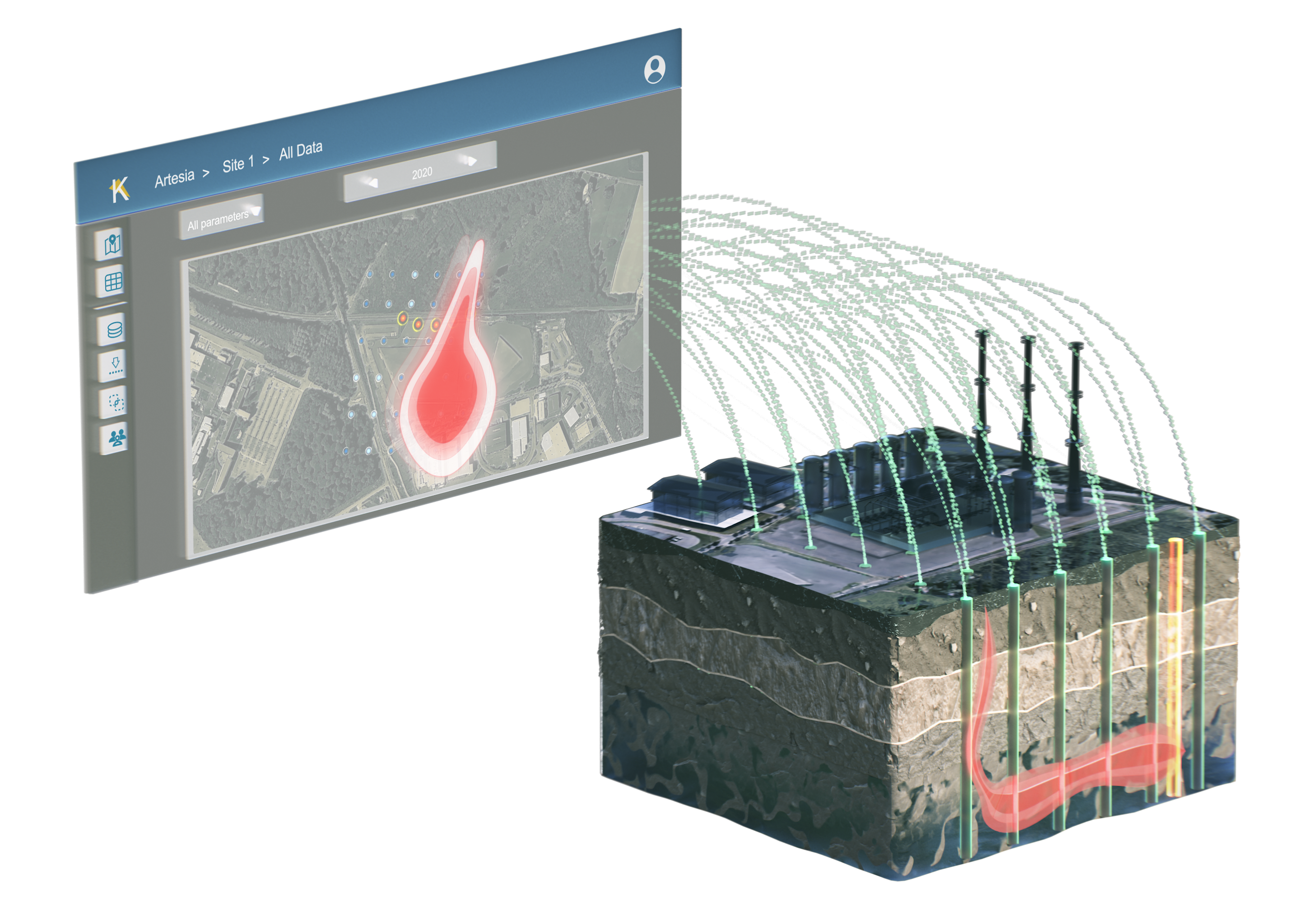
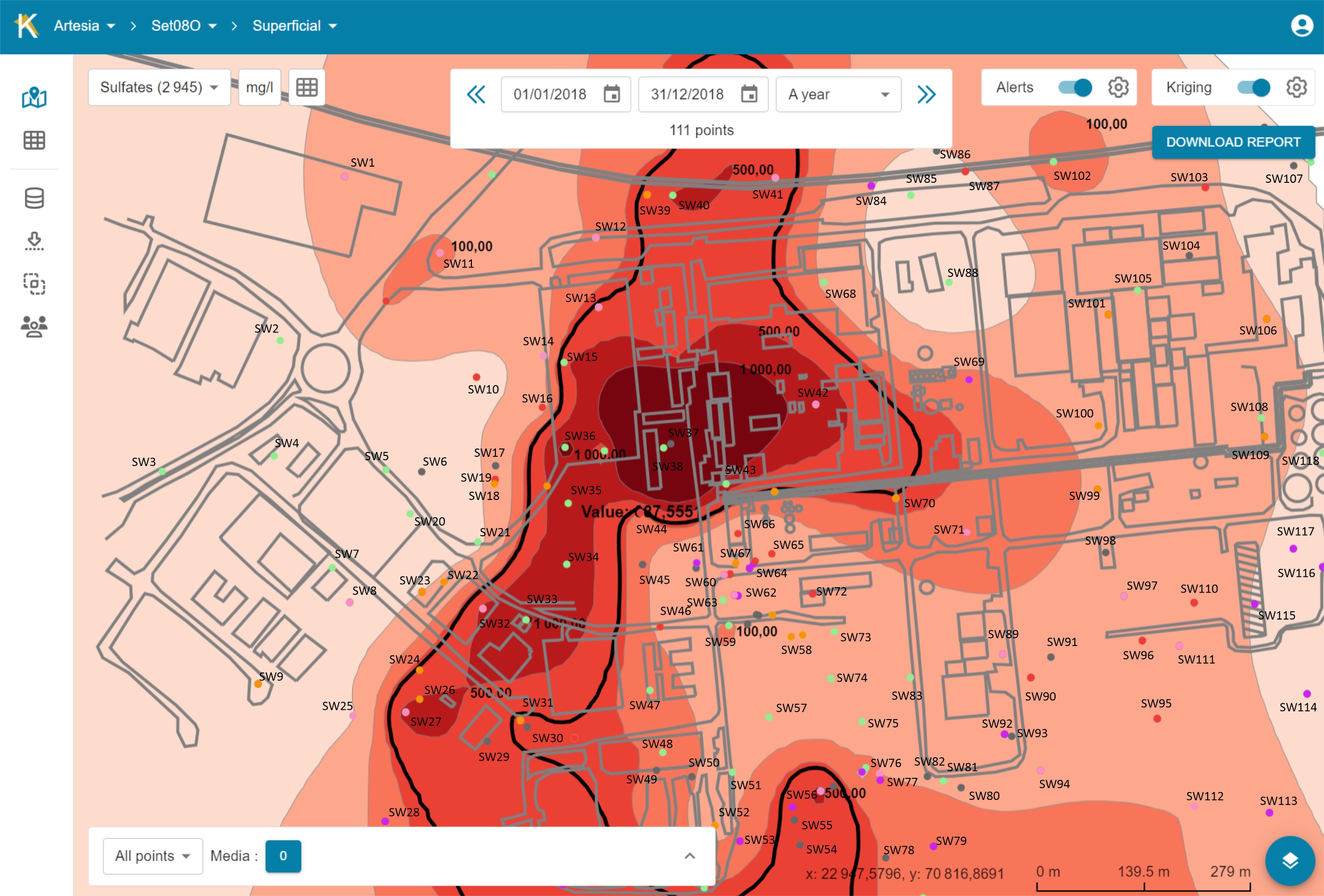
ON MAP CONSULTATION WITH INTERPOLATION
The instantaneous interpolation of the pollutants concentrations, generated automatically, provides at a glance a map of the state of the site, highlighting the areas to be monitored.
By navigating from one measurement campaign to another with a simple click, you get a film of the evolution of the concentrations up to today, which allows you to anticipate the future evolution and make strategic decisions of production, decontamination or containment.
Alert system
Krigis detects worrisome increases and asks to consult the history of certain points designated by the system
SMART ESG REPORTING
KRIGIS automatically generates material for reports as well as pollution indicators assessing changes in the pollution, which are essential for drawing up ESG annual reports.
You therefore rely on clear and precise communication with stakeholders and authorities.
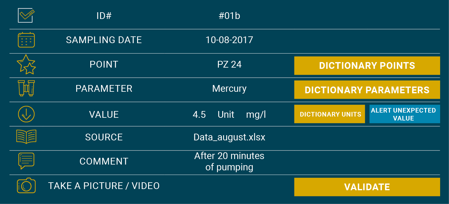
SMART DATA IMPORT
Powerful import tools allow for debugging of data before it is entered into the database. Intelligent systems allow KRIGIS to recognize encoding errors and to suggest corrections, spelling of well names and chemical compounds are adjusted, units are changed automatically, water depths are transformed into piezometric levels and the pumped volumes generate flows. Statistical analysis warns against unrealistic or very worrisome measures.
SMART DATA SHARING
Thanks to its ability to select group of wells or groups of chemical compounds, the analysis is very flexible. KRIGIS helps you to easily select the data to share with collaborators. You can share data selections, spreadsheets and pollution maps with other users.
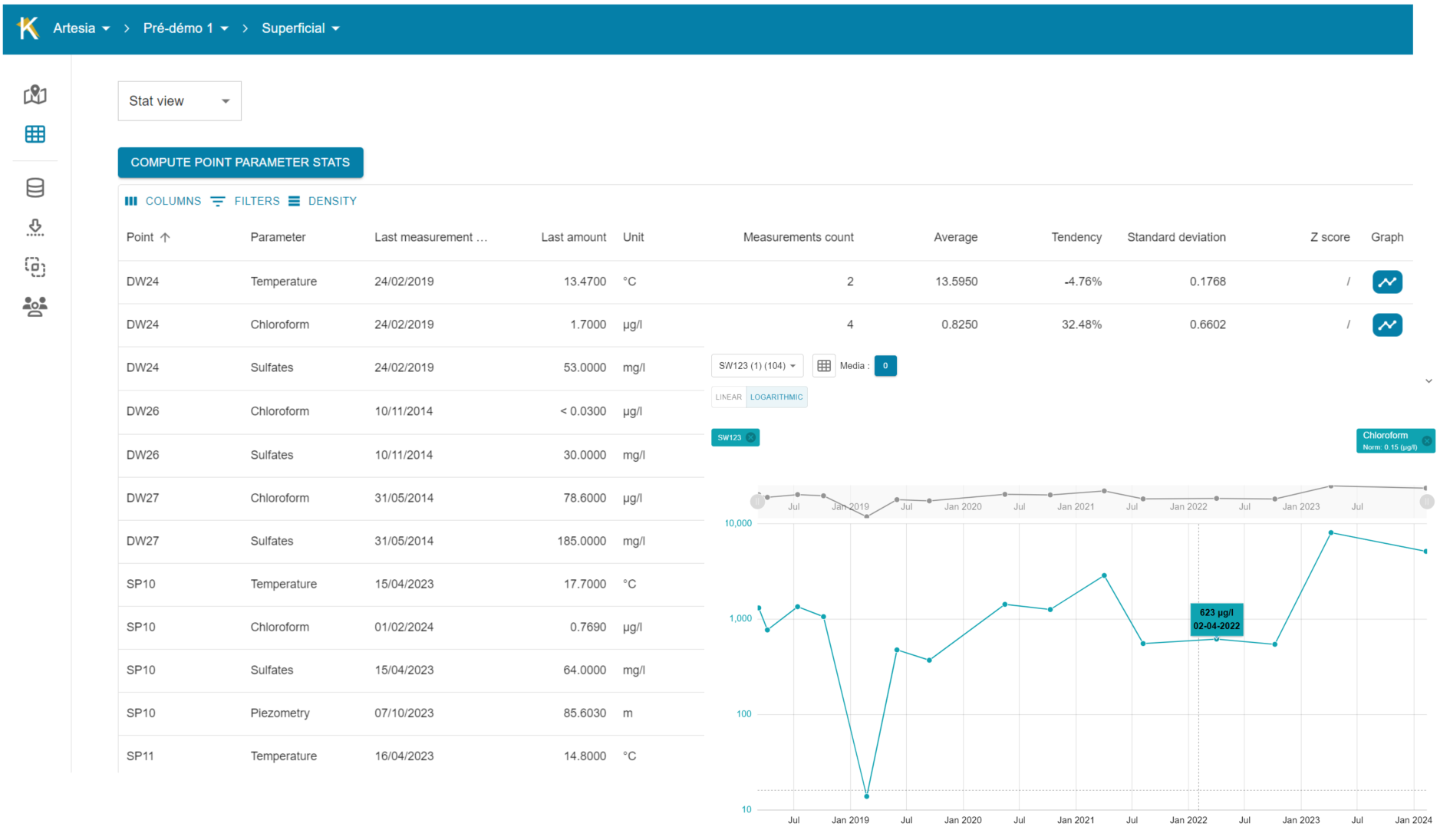
TABLE CONSULTATION
KRIGIS is very interactive: by clicking on a point, you get its history.
The data tables remain easily accessible and are abundant in analysis support resources: automatic charts, crucial statistics, ability to analyse a particular campaign, well or chemical compound on an individual basis. It is ideal for detailed analysis in a familiar environment with simple spreadsheet.
YOUR DATABASE BECOMES MUCH RICHER THAN ANALYSIS LISTS
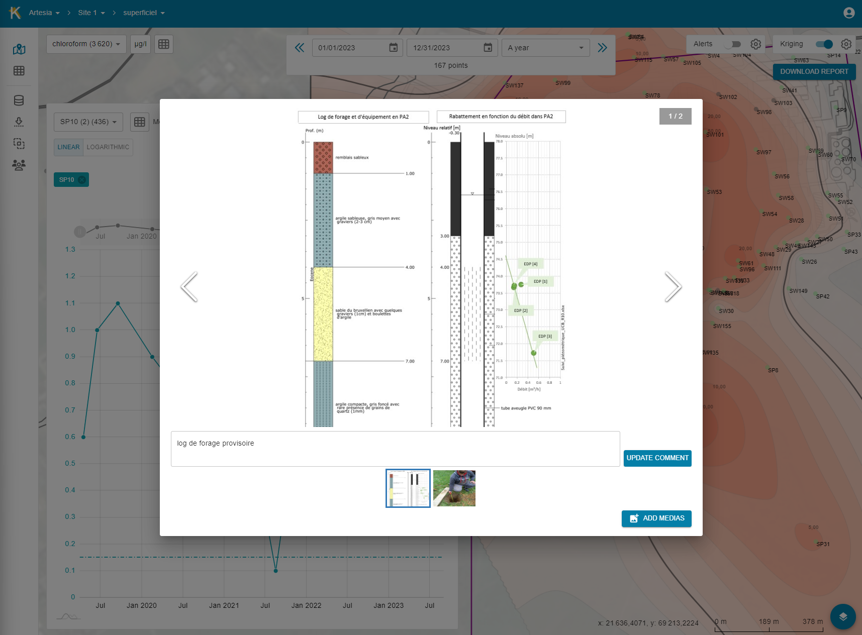
In addition to measurements, you have maps, photos and field films, drilling logs and all this accessible on plan